
How does CERES Protect works?
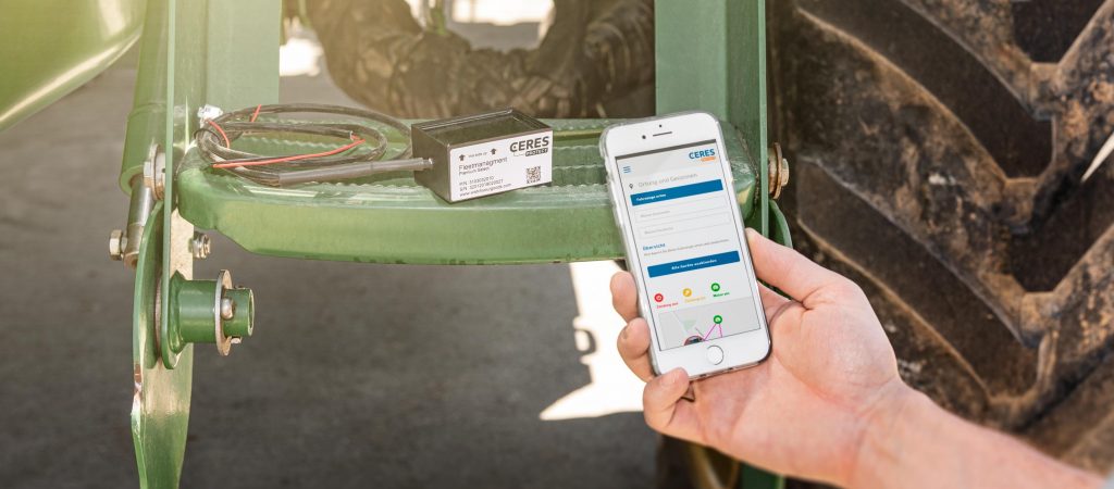
- All of the technology in CERES Protect – and in the GPS device as well – is housed in a compact Box. You simply mount this Box on your vehicles, trailers, or machines
- After you connect the Box to the web application, location data collected by the GPS device is exchanged with the web application
- Data is transmitted via wireless networks. You will select a tariff when you place your order
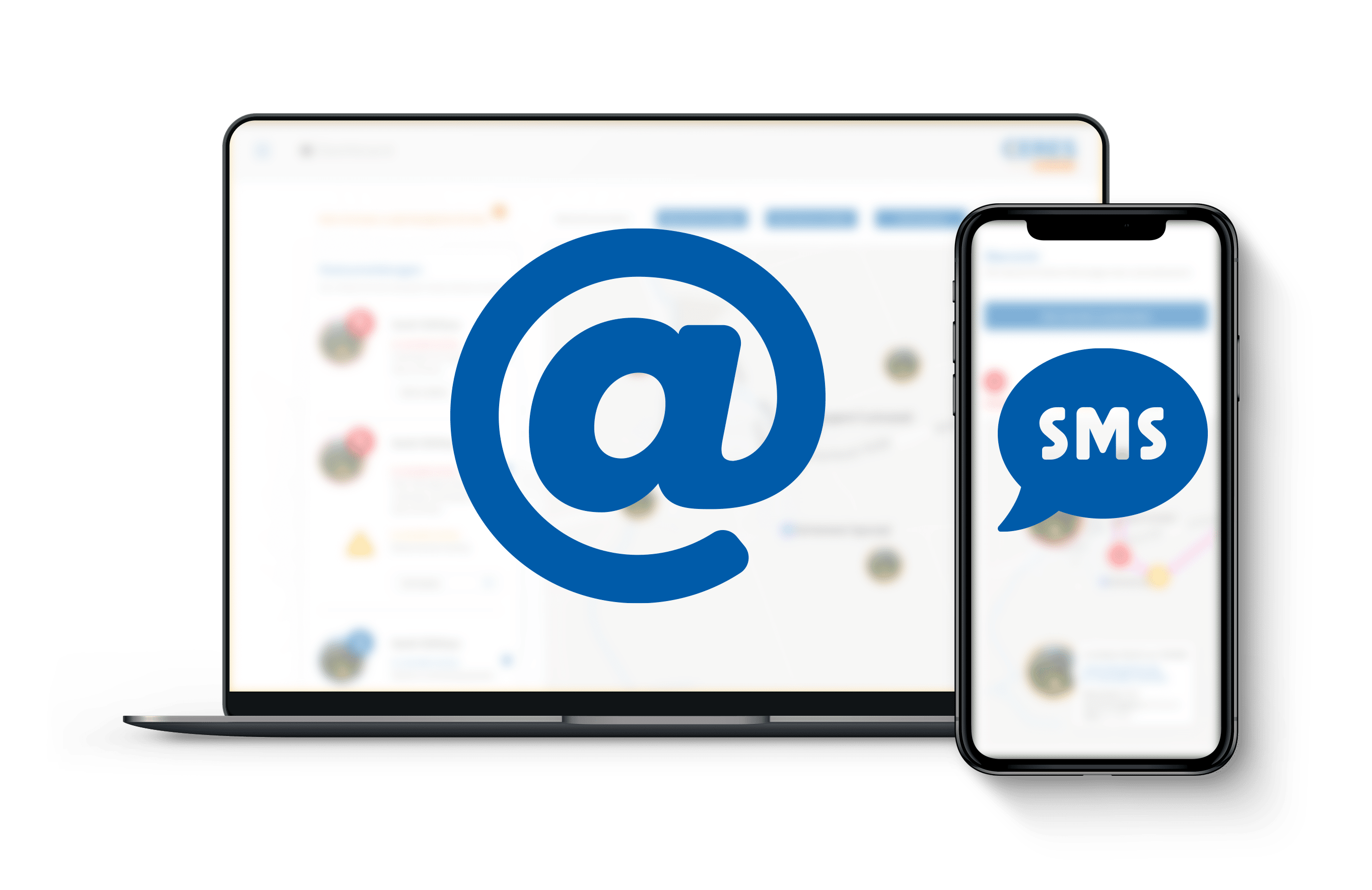
- CERES Protect has an adjustable shock sensor, a daily “timer”, an ignition sensor, geo-zones and two switchable outputs. You can use rules to stipulate what should happen when in the web portal. You can receive notifications via e-mail and SMS
How to mount the box to the vehicle?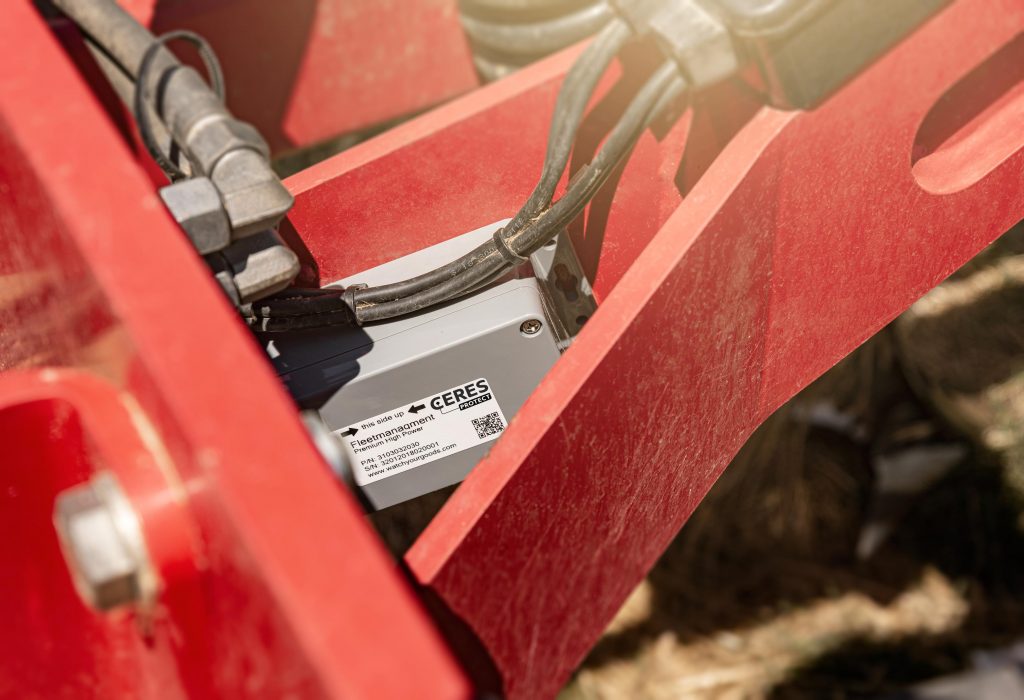
- You can mount CERES Protect inside or outside of the vehicle. The sturdy Box is equipped with splash-proof electronics designed for use in difficult environmental conditions
- The integrated GPS receiver should have a direct line of sight to the sky if possible, and not be covered by any sheets of metal
- The better this line of sight is, the more precise the calculated position will be
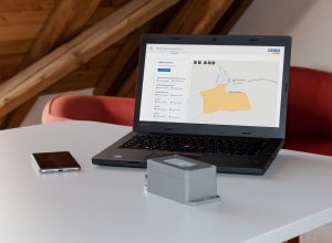
How do I register on the web portal?
- You will need the CERES Protect Box to launch the web application the first time
- Your personal Quick Start Guide is included in the delivery
- It provides all the information you need to register on the web portal: The serial number of your device and your personal registration code
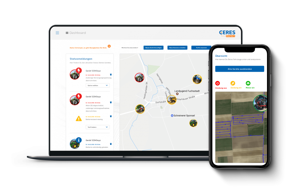
What can I do with CERES Protect?
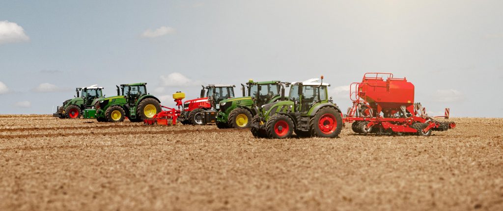
- Add one or more devices to your account so you can equip your entire fleet with CERES Protect
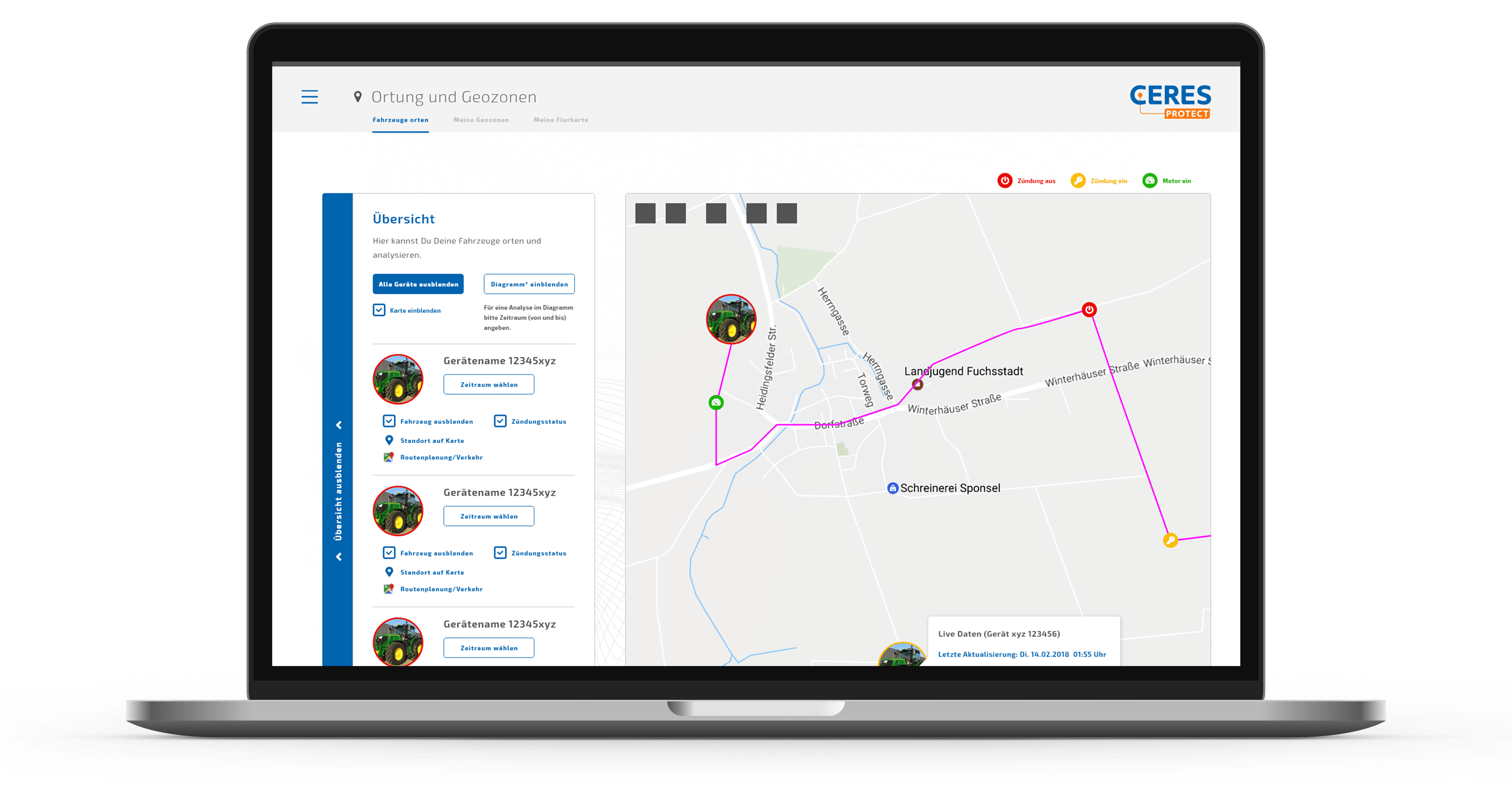
- Always have information on where your vehicles are currently located
- Track your vehicles in real time on your smartphone, tablet or computer
- Configure CERES Protect’s transmission intervals to meet your needs
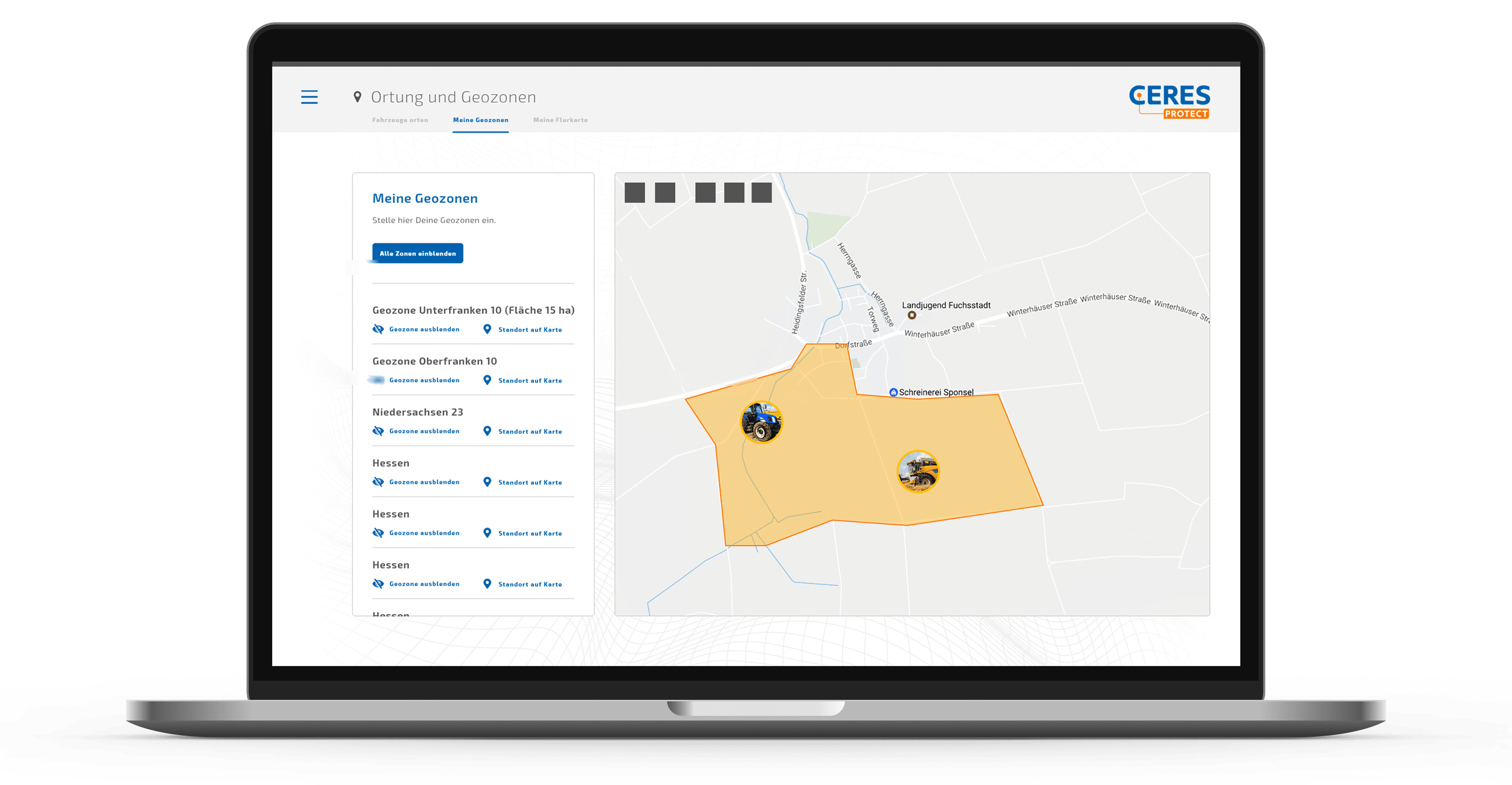
- Establish your own rules, for instance that your vehicles may only be within a certain area at a certain time
- Create custom messages to receive a notification if a rule is broken
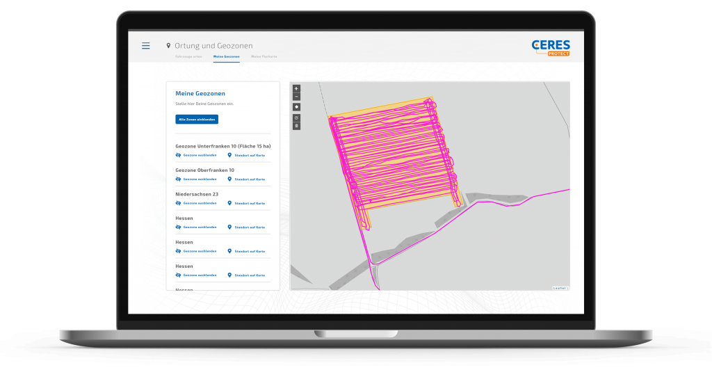
- Establish your own geo-zones, for instance around your depot or warehouses
- Upload your own field map and have a good overview of your fields
- Analyse driving data for your vehicles and store it for the long-term
- In the Live Connect tariff you can have areas calculated automatically. The calculation is carried out using the recorded lane. All lanes used for the calculation are coloured. This gives you visual control over your work.
In our YouTube channel you will find helpful videos that show you step by step which settings you can make in the web portal.


 siert, hast Du die Möglichkeit Deine Box bei uns kostengünstig in unserer professionellen Reparaturwerkstatt reparieren zu lassen.
